The Llyn Peninsula & Bardsey Island, Wales
We left Tremadog, where we had overnighted at The Golden Fleece Inn, heading west towards Aberdaron, which is the last village on the Llŷn Peninsula.
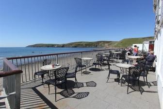
However, before I continue, I must let you know about this little gem of a place to stay… I am unsure if I should call it an Inn, a Pub, a Tavern, a Hotel or a Guesthouse, because it as all of these and more.
The Golden Fleece Inn is to one side of the market square, which forms the major part of the small village of Tremadog, in Gwynedd, Wales and, as it happens, is on the route we were taking along the Llŷn Peninsula.
As the day was drawing into evening, we decided we would find a bed for the night and by hook or crook we found a direct number to the Golden Fleece Inn.
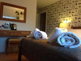 The room we took was a small double, situated in a cottage facing the market square and adjoining the main building. When I say small, I mean compact. It is not accommodation you would want to use for anything more than a one or two-night place to wash and sleep. But as we were only staying the one night and all we needed was to wash and sleep, it was perfect. Spotlessly clean, tidy, with tea/coffee making, storage, shower and a very comfortable bed. The price, including a full English breakfast, was extremely reasonable too.
We could have dined in the restaurant or bar that evening, but we had eaten before arrival so declined. However, the breakfast, which offered just about everything most people require, was very tasty and cooked freshly to order. The full English… or rather the Full Welsh breakfast comes well recommended by yours truly!
Should we have wanted to stay longer, or indeed make this our base for exploring this area of Wales, The Golden Fleece offers a whole range of accommodation to suit just about everybody’s needs, from single bedrooms to king and executive suits, through to two and three bedroom holiday cottages.
We, my wife and I, found the staff friendly, informal and relaxed, which added to the enjoyment. I suggest you seriously consider the Golden Fleece Inn when choosing your own accommodation in this part of Wales.
Anyway… on with the post.
Aberdaron is the final place west you can travel before getting your feet wet. Bardsey Island is a short boat trip out to sea, but, being an island, it could prove rather difficult to walk or drive to should one care to try.
Leaving Tremadog we took the south coast road, (A497) and soon found ourselves in a quaint little seaside town of Criccieth and parked the car on Lon Felin, overlooking the sea.
We decided we would take a mooch around the village, not knowing there is a rather famous Castle. Anyway, we looked around the Criccieth lifeboat and made a donation before wandering up a rather steep hill where we found Criccieth Castle.
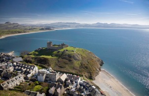 It seems this Castle gave its name to the town, rather than the other way around which is most common. Cadw, the Welsh Government’s Historic environment service, suggests the origins come from ‘crug caeth’ – ‘crug’ (meaning hill in Welsh), ‘caith’ (captives) – the name given to the jail on the hill, the function once held by the castle.
Criccieth castle has a long history; so badly did the native Welsh princes and English monarchs want to own it, it changed hands more often than a relay baton. Owain Glyn Dŵr sealed Criccieth’s fate when his troops captured and burnt the castle in the early years of the 15th century.
This was to be the last major Welsh rebellion against the English.
After a mooch around, cut short by a light rain shower, we set off along the coast road once more.
Passing through Pwllheli we meandered along the promenade, stopping once to walk onto the beach and admire the view. We did not stay long because the weather that day was a little blustery and one of the occasional rain showers set in.
Leaving Pwllheli we took the A4415 through Rhyd-y-Clafdy and then Nanhoron before we made a detour from the main roads to find some scenic views.
Taking a circuitous route is something we regularly do while travelling, wherever we are. The whole point of travelling as far as I am concerned is the journey, the destinations one finds themselves at are merely punctuation marks en route.
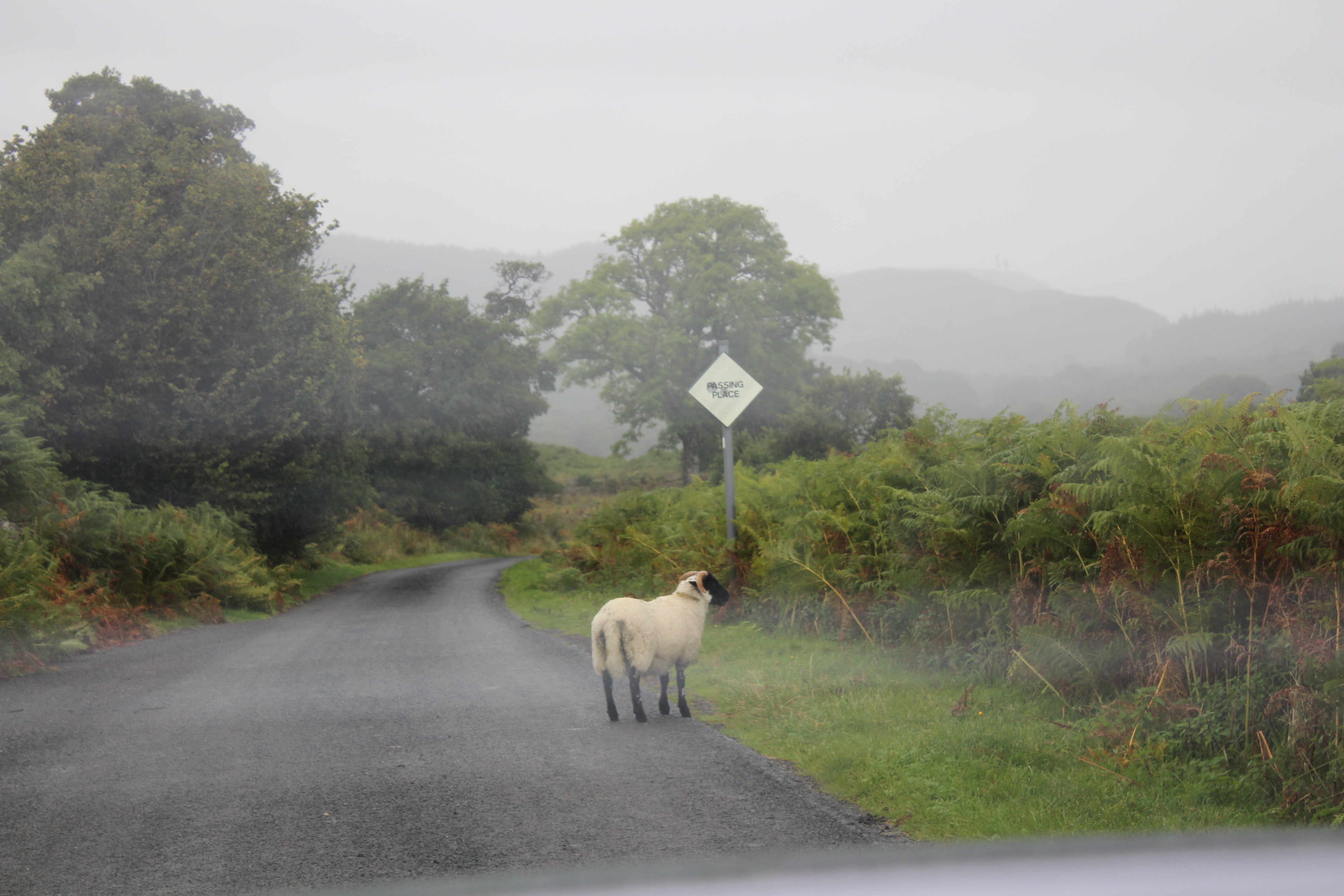
The route we chose, by arbitrarily following road signs that seemed to indicate somewhere interesting, took us to the north coast of the peninsula and to a place called Whistling Sands.
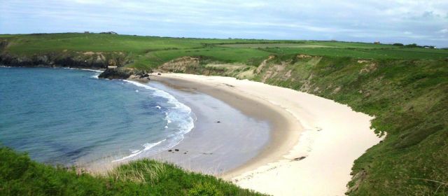
Yes, from heading west on the south coast we were now visiting a beach on the north coast. This is not as strange as you might think. You see, the Llyn peninsular is only, on average about 7miles wide, so to go from south to north is not really the detour it first sounds like.
We now find ourselves on a small, picturesque National Trust beach, which is backed by steep grassy cliffs. The name ‘Whistling Sands’ is based on the sound created by the beach as you walk over the sand. Experts, the geologists and such who know far more than I, say the sound is created due to the shear stress of weight put upon the sand.
Certainly, if you scrunch your feet back and forth long enough or slide them over an area for a short while, the sand does emit a strange squeaking sound. Maybe I need to improve my technique to get the full effect? Whistling Sands, also known as Porthor, (Porth Oer in Welsh), is one of only two beaches in Europe where you can experience this phenomenon for yourselves.
Whistling Sands, Porthor, Aberdaron, Pwllheli. O/S ref SH174264
Thankfully the weather was much improved from earlier in the day. The sun was shining and the wind now a gentle breeze, so we took the opportunity to wander the length of the bay, collect a few pebbles and shells and take a few snapshots.
There is a long-established café on the beach, so food and drink are readily available.
The afternoon was passing on and we had not reached our day’s destination or booked anywhere to stay the night, so we jumped back in the car and set off for Aberdaron.
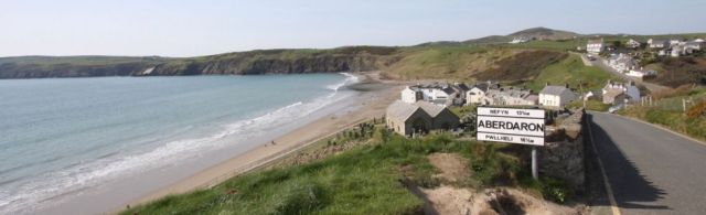
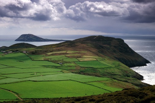
Aberdaron lays at the farthest western point of the peninsula, it is a small village, formerly a fishing village, located in a valley at the confluence of the Afon Daron and Afon Cyll-y-Felin, between the headlands of Uwchmynydd to the west, and Trwyn y Penrhyn to the east. Aberdaron’s population is 965. (from the last census figures).
The population may be small, but on a daily basis throughout the season, throngs of tourists and day-trippers visit the village, sometimes seemingly overwhelming the few pubs and cafes.
We were fortunate in securing a room at Gwesty Tŷ Newydd, which is situated directly on
Aberdaron’s beach. I had to laugh as the room we took had the wonderful title of the ‘Love Room’… now, before you go all coy on me, it is not a honeymoon suite or any other type of ‘special room’. The name simply comes from a fellow called Love Pritchard, who was once the king of Bardsey. (An island offshore of Aberdaron, and one which I shall write of soon, as that island was to be our next destination.)
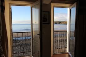
The Love Room has two large windows which offer a direct view over the bay. I would suggest you ask for this room or one of the other, I think there are two more, with such a view. It is wonderful looking out, especially first thing in the morning when the beach is all but empty.
The Gwesty Tŷ Newydd is a relatively inexpensive hotel of 11 rooms. Parking can be a little difficult as the hotel does not have a car park, but there are alternative arrangements, such as the cottages or the national trust car park. But I would not concern yourself too much about that. It is all easily manageable and a small inconvenience to pay for what is otherwise a pretty faultless hotel.
The in-room facilities are top notch, as is the beer… I recommend you try some local Welsh brews. The food was well cooked and presented, both in the evening and at breakfast. The staff friendly although a little slow at times, but that could just be the slower, more laid-back pace of life here.
Overall, if you visit Wales you must Visit the Llyn peninsular and Aberdaron in particular.
The next part of this adventure is our trip to Bardsey, the ‘Holy Island’ just off the coast of Aberdaron. It is a lightly populated small island which has no gas, no electricity, no internet, no roads and no cars… and it is wonderful… more about Bardsey in another post.
Thank you for reading Wild Geese.
Please ‘follow’ this blog to stay informed and not miss any new posts. Knowing we have your support encourages us to write more and more often.
You might like to take one of these books, recommended by Wild Geese Travel, on your next journey? You can find them on Paul’s website, http://paulznewpostbox.wix.com/paul-white