
Generally, we, (my wife and I), have no set plan. We simply load the car with whatever we need and drive north until we cross the border. (Yes, I am a Sasanach).
While we have a rough idea of where, geographically, our first overnight stop will be, we pretty much leave it to fate and circumstance to where we actually arrive and where we go from there.
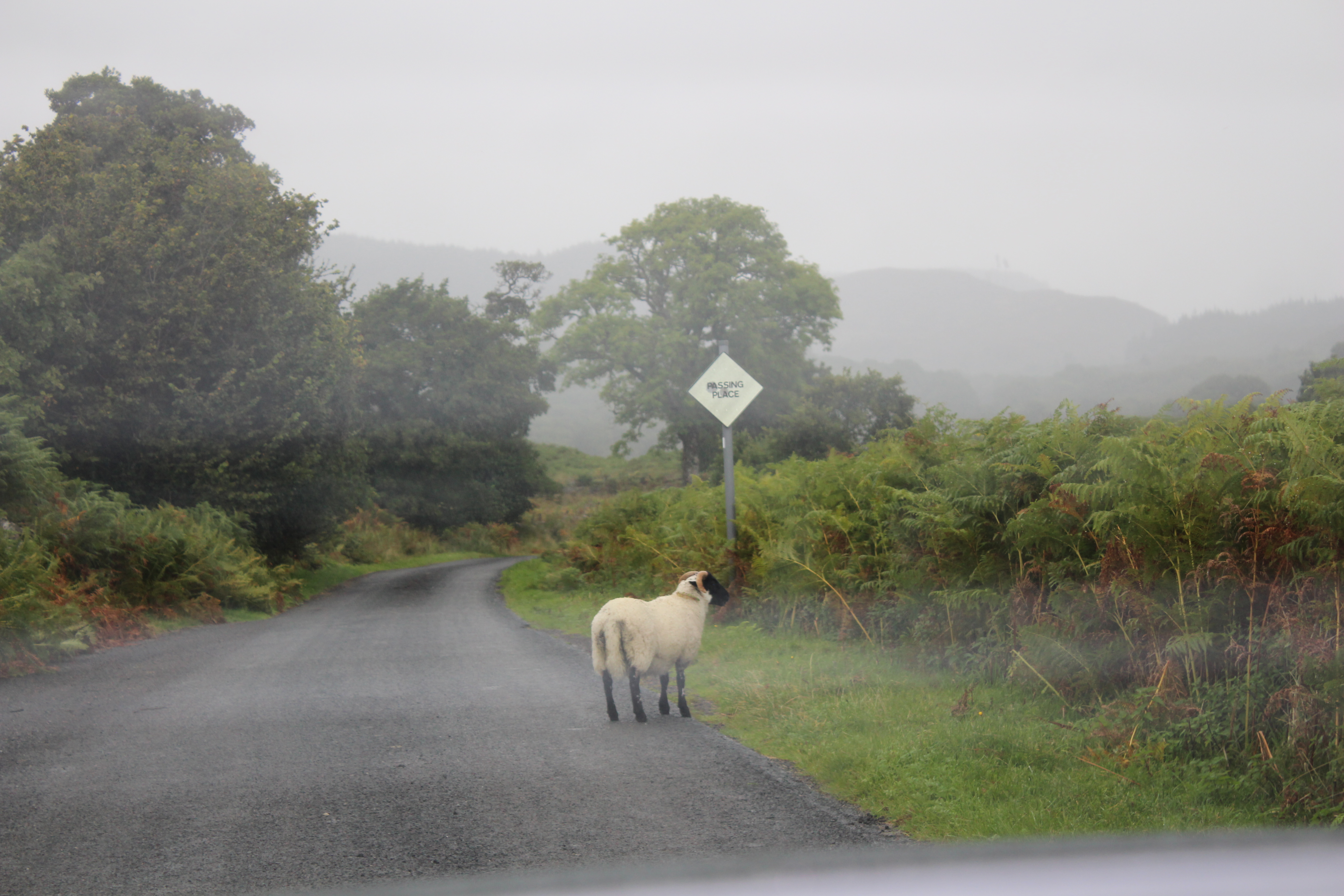
On our last visit, in January, from which we returned about one week ago as I write this, we travelled to the Mull of Galloway, which is the furthest southernmost point of mainland Scotland.
This gave me an idea for the areas to visit on my next journey north, which will be just before or shortly after Easter. (Once the hoards of children are again safely ensconced in their schools).
I shall, of course, take my trusty camera and snap a few shots and write a post or two about that trip.
In the meantime, below is some information about Dunnet Head and the Mull of Galloway, which includes some of my photographs. (All my photos are copyright, so please don’t share without my written consent, thank you.)

North.
DUNNET HEAD.
Dunnet Head in Scottish Gaelic is Ceann Dùnaid.
It is a peninsula in Caithness, on the north coast of Scotland which is also the most northerly point of the mainland of Great Britain. (The point is also known as Easter Head.)
Although Dunnet/Easter Head is the most northerly point on the Scottish mainland, the northernmost point of Scotland lies in the Shetland islands, approximately 170 miles further north.
To the north of the village of Dunnet, the land rises to form Dunnet Head whose cliffs fall 300ft sheer into the Pentland Firth. The headland is some 3.5 miles from north to south and 2.5 miles from east to west.

The northern end is home to several disused lookouts and other structures built during World War II to help defend the naval base at Scapa Flow on Orkney.
Sitting above the cliffs is the lighthouse built here by the Stevenson family in 1832.
The headland’s boundary with the rest of the Scottish mainland can be defined as a north-south line running from Little Clett (ND220740) to the mouth of Dunnet Burn (ND217709) in Dunnet Bay.
This line is followed along most of its route by a single-track road, the B855, which links Brough with the village of Dunnet, making this the most northerly road on mainland Britain. From this line, the headland projects westward and northward into the Atlantic Ocean and the Pentland Firth and shelters the more southerly waters of Dunnet Bay.

South.
MULL OF GALLOWAY.
The Mull of Galloway in Scottish Gaelic is Maol nan Gall, pronounced [mɯːlˠ̪ nəŋ ˈkaulˠ̪].
The Mull of Galloway is Scotland’s most Southerly Point. It is situated in Wigtownshire, Dumfries and Galloway, at the end of the Rhins of Galloway peninsula. (Grid reference NX158303.)
This place is one of the best-kept secrets in the UK. The Rhins of Galloway peninsula remains an unspoiled paradise for visitors on the lookout for peace and tranquillity.
Beautiful countryside awaits you in the Rhins of Galloway, together with miles of sandy beaches, splendid views and cliff top walks. Wildlife in the area is abundant and the Mull of Galloway is one of the best places in the UK to view dolphins, porpoises and many seabirds. The warm climate means that the area is blessed with stunning gardens, each with its own individuality, and a variety of plants and trees.

East.
KEITH INCH is the easternmost point of mainland Scotland.
‘Inch’ is a common Scottish word for an island, e.g. Inchcolm, Inchkenneth, and na h-Innse Gall (Hebrides) it derives from the Scottish Gaelic, innis.

West.
It lies at the western end of the Ardnamurchan peninsula in Lochaber, Scotland, 1.1 kilometres, 0.68 miles north of Corrachadh Mòr.
It is the most westerly point on the island of Great Britain, which is a few metres further west than the point itself.


Centre.
NEWTONMORE
Newtonmore is the village that is closest to the Centre of Scotland… BUT… claims to the actual centre are contentious.
Some say, the centre point of Scotland, including the islands, is at grid reference NN6678471599 (56°49.0153′N 4°10.959′W Coordinates: 56°49.0153′N 4°10.959′W). This location is on a hillside near Loch Garry, between Dalwhinnie and Blair Atholl and close to the A9 road and the railway line.
http://news.bbc.co.uk/1/hi/scotland/2271926.stm
Another cruder method used for this calculation is to, take the intersection between the line of latitude midway between the most northerly and southerly points on the Scottish mainland, and the line of longitude midway between the most easterly and westerly points.
In the days when Corrachadh Mòr in Ardnamurchan was undisputedly the most westerly point, this also produced 56 degrees 39 minutes N, 4 degrees 0 minutes W, very near the summit of Schiehallion.
However, the construction of the Skye Bridge, arguably turning Skye into part of the Scottish mainland, may have upset some of these calculations.
Nearby lies the village of Newtonmore, Badenoch. The site was marked by a stone, with a cross etched into it, in the dry stane dyke on the north side of the road on the eastern slopes of Dun Coillich in Glengoulandie, east of Schiehallion.
UPDATE… after my visit… I found…
The stone, with a cross etched into it, near Newtonmore, Badenoch, Highland and the Ordnance Survey centre of mainland Scotland on the slopes of Dun Coillich in Glengoulandie, east of Schiehallion, Perthshire. Are different locations.
One is in Badenoch, Highland and the other in Perthshire.
By road Newtonmore, Badenoch, Highland is about 38 miles from the Ordnance Survey centre of mainland Scotland on the slopes of Dun Coillich in Glengoulandie, east of Schiehallion, Perthshire.
“As the crow flies”, the distance between Newtonmore, Badenoch, Highland and the Ordnance Survey centre of mainland Scotland in Perthshire is at least 28 miles.
Newtonmore is a little over a mile, 2 km, west of the A9, along the Glen Truim Road.
I am told the stone with the cross is still there and it is great fun looking for it. You will find it a few yards before you reach a triangular forestry road junction, (with a local walks waymark board), and about 125 yards before you reach the superb Macpherson Monument, from where you can enjoy terrific views of the upper Spey Valley… or so I am told.


When you next take trip, why not take along one of my ‘Pocketbook’ paperbacks?
They are full books, real books, just printed in a size which will easily slip into your pocket, bag, or backpack.
Check them out, here Watch the video, here.


Entertaining, delightful, can’t think of any other words. As always Paul a joy to read!
LikeLike
Many thanks, Scott.
LikeLike